Ouray ATV Trails: Alpine Off-Road Riding Guide

Alana Azzouz is a Senior Editor at Searchshop Media Network with over a decade of experience in consumer content quality and editorial standards. She has reviewed thousands of product guides, buying articles, and comp…
Why trust us
BestATVTrails trail guides are researched by riders with decades of powersports experience. Our lead researcher spent 30+ years in powersports retail and has ridden trails across a dozen US states. Every gear recommendation is sourced from real product research matched to specific terrain — not paid placements or generic affiliate lists.

Ouray ATV Trails: Alpine Off-Road Riding Guide
Gear for This Trail

Cold weather, altitude, rock impacts, and route-finding all matter in Ouray. We recommend focusing on full-face protection, impact coverage, navigation, and weather-ready utility gear.
| Gear Type | Brand | Product | Why it suits Ouray ATV trails | Approx. Price |
|---|---|---|---|---|
| Helmet | Bell | Qualifier Full-Face Helmet | A full-face helmet makes sense here because Ouray’s roads are rocky, exposed, and often cold at elevation. The Bell Qualifier gives solid coverage, venting, and a faceshield for wind, dust, and sudden weather. | $120-$180 |
| Protective gear | Alpinestars | Bionic Action Chest Protector | On steep, rocky mining roads, upper-body impact protection is worth having. This model adds chest and back coverage without being overly bulky for long seated climbs. | $130-$180 |
| Gloves | Fox Racing | Dirtpaw Gloves | Ouray demands steady grip on rough descents and cold morning starts. These gloves offer knuckle coverage, dependable bar feel, and enough durability for rocky terrain. | $25-$40 |
| Terrain-specific item | Garmin | Tread Powersport Navigator | A dedicated powersports GPS is especially useful in the Ouray/Silverton pass network where multiple junctions, county roads, and weather reroutes can complicate navigation. It is much better suited than relying only on weak cell service. | $500-$700 |
| Recovery / utility | Rhino USA | Recovery Tow Strap | Even without deep mud, breakdowns and off-line moments happen on steep mountain roads. A quality tow strap is a smart backup for group rides where one machine may need help on a climb or descent. | $30-$45 |
| Comfort / weather item | Nelson-Rigg | Hurricane Dual-Sport/ATV Dry Bag | Afternoon storms are common, and spare layers, gloves, tools, and snacks need to stay dry. A waterproof bag is one of the most practical upgrades for all-day alpine rides. | $60-$100 |
If we were prioritizing purchases specifically for Ouray, we would start with the full-face helmet, chest protection, and a reliable GPS. This region is too exposed and too changeable to treat navigation and protection as afterthoughts.
Introduction
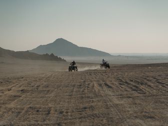
Ouray ATV trails are some of the most dramatic high-country routes in Colorado, combining old mining roads, narrow shelf sections, tight switchbacks, and mountain passes that climb above 13,000 feet. Riders come here for the scenery as much as the challenge: jagged San Juan peaks, abandoned mining structures, waterfalls, and long views that make every climb feel earned.
From town, you can connect into a broad network that includes famous routes like Yankee Boy Basin, Corkscrew Pass, California Pass, Hurricane Pass, Engineer Pass, and links toward Imogene Pass and Ophir Pass depending on machine type, route legality, and current conditions. What makes this area special is the variety packed into one riding destination. In a single day, we can move from graded gravel to loose rock ledges, from damp forest sections to exposed alpine shelf roads where weather changes fast.
Ouray is not a casual flatland trail system. It is a true alpine off-road destination where altitude, cold rain, and steep terrain matter. For riders who want unforgettable mountain riding, however, few places in the West compare.
Trail Overview

The Ouray area is better thought of as a connected alpine road and OHV route network rather than one single trail. Most riders base out of Ouray, Colorado, then build loops using county roads, high-clearance passes, and designated motorized routes through the San Juan Mountains.
Key stats
- Trail system type: Connected alpine pass and mining-road network
- Approximate rideable mileage: Roughly 100+ miles of common ATV/UTV-accessible routes in the immediate Ouray-Silverton-Lake City region, with longer connected options depending on route planning
- Difficulty range: Blue to Double-Black depending on pass, weather, and machine width
- Elevation range: About 7,800 feet in Ouray to over 13,000 feet on high passes like California Pass
- Best season: Typically late June through September, with July through early September being the most reliable
- Nearest town: Ouray, with support also in Silverton and Lake City for longer route days
- Permit requirements: Colorado OHV registration or permit may be required depending on machine type and residency; street-legal requirements apply on some connecting roads
- Land management: Mix of San Juan National Forest, county roads, and mountain pass routes
Because snow lingers deep into summer, early-season access changes year to year. A pass open in July one season may not be ready at the same time the next. We recommend checking with the Ouray Ranger District, San Juan National Forest, and county road updates before committing to a route.
Trail Conditions & Terrain
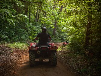
Ouray’s terrain is what gives the area its reputation. These are mostly historic mining roads and mountain passes, not groomed ATV park trails. Expect rocky two-track, embedded stone, loose shale, chunky climbs, water runoff channels, and sections where the road narrows along steep drop-offs.
Lower elevations near town and in forested sections often begin with hard-packed dirt and gravel, but conditions usually get rougher as we climb. On routes such as Corkscrew Pass and California Pass, the surface can turn into loose red scree, angular rock, and off-camber shelf road. On Engineer Pass, we often see a mix of rock ledges, washboarding, and erosion damage after storms. Yankee Boy Basin can be milder in dry weather on the main route, but side conditions, traffic, and rain can still make it technical.
The biggest challenge here is not deep mud or sand. It is exposure, altitude, and traction management on steep grades. Long climbs can strain smaller-displacement machines, and thinner air above 10,000 feet reduces engine performance. Descents matter just as much. We recommend strong braking technique and careful line choice because loose downhill switchbacks can be more demanding than the climb up.
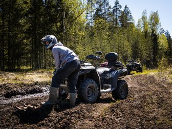
Water is another factor. While this area is not known for repeated major creek fording like some lower mountain systems, riders should still expect standing water, runoff crossings, puddled rock sections, and wet ruts after storms or snowmelt. Afternoon thunderstorms are common in peak season, and a dry road can become slick quickly.
A few defining terrain traits of the Ouray system include:
- Steep switchbacks on narrow mountain roads
- Shelf-road exposure with significant drop-offs
- Loose rock and baby-head stone on climbs and descents
- Ruts and erosion channels from runoff
- Cold, wet weather potential even in summer
- Traffic from Jeeps, UTVs, motorcycles, and sightseeing vehicles on popular routes
These are not ideal trails for aggressive high-speed riding. They reward patience, steady throttle, and route awareness.
Difficulty & Who It's For
Because the Ouray network includes multiple routes, difficulty varies a lot. We use the Green / Blue / Black / Double-Black scale to help riders match expectations to the terrain.
Green: Limited in this area
There are a few easier connectors and graded sections near town or on lower roads, but Ouray is not primarily a Green-level destination. Beginners may find short scenic stretches manageable in perfect weather, especially if they stay on wider roads and avoid the highest passes.
Best for: New riders with an experienced group, conservative route plans, and a machine in excellent condition.
Blue: Intermediate
Routes like portions of Yankee Boy Basin Road in good weather or easier connecting roads can fit the Blue category. Riders still need to be comfortable with loose rock, mountain traffic, and sustained climbs.
Best for: Intermediate ATV riders who already know how to manage throttle, braking, and body positioning on uneven mountain roads.
Black: Advanced
Much of the classic Ouray pass riding falls into Black territory. Engineer Pass, Corkscrew Pass, and sections connecting toward Hurricane and California Pass often involve steeper grades, rougher rock, tighter turns, and more exposure.
Best for: Experienced riders with mountain-riding confidence, good judgment, and machines prepared for altitude and rough terrain.
Double-Black: Expert / condition-dependent
Certain shelf-road sections, storm-damaged roads, narrow switchbacks, and high-exposure routes can feel Double-Black, especially when wet, crowded, or partially washed out. Even a route that is usually manageable can become expert-only when weather moves in.
Best for: Highly experienced riders who are comfortable with exposure, technical line selection, and changing alpine conditions.
Our overall rating
For most visitors, we rate the Ouray trail network as Black overall, with Blue-to-Double-Black variability depending on exact route and conditions. This is a destination for riders who want serious alpine terrain, not a casual first ATV weekend.
Permits & Access
Access around Ouray can be confusing because riders may use a mix of county roads, forest routes, and OHV-designated segments. The exact legal requirements depend on whether your ATV is street legal, where you are connecting, and whether your machine is registered in Colorado.
Parking and staging
Many riders stage from Ouray itself, from lodging with trailer parking, or from legal pullouts and staging areas outside the busiest downtown core. Some riders also base from Silverton depending on the planned loop. Parking availability changes during peak summer tourism, so arriving early helps.
Permit and registration basics
- Colorado OHV registration is generally required for Colorado residents operating an OHV on designated OHV routes.
- Nonresident OHV permits are generally required for out-of-state OHVs using Colorado public lands and designated routes.
- If your machine is fully street legal and plated, some road segments may be accessed under different rules, but that does not automatically replace OHV compliance on every route.
- Fees change periodically, but riders should expect Colorado OHV registration or permit costs to be in the roughly $25-$35 range.
Reservations
- No general trail reservation system applies to the Ouray pass network.
- Lodging in Ouray books quickly in peak season, so we recommend reserving rooms or campsites well ahead of time.
- If using specific campgrounds in the national forest, separate camping reservations may apply.
Important access notes
- Some famous passes in the region are more suitable for narrow ATVs and motorcycles than wider side-by-sides.
- Seasonal closures due to snow, washouts, maintenance, or storm damage are common.
- Local route legality can change, especially after heavy runoff or road repairs.
Before riding, we recommend checking:
- Colorado Parks and Wildlife OHV registration information
- San Juan National Forest / Ouray Ranger District conditions
- Ouray County and San Juan County road status updates
Tips for Riding This System
Start early to beat storms. In the San Juans, afternoon weather builds fast. We recommend being over the highest passes before storms develop, especially if lightning or cold rain is in the forecast.
Respect altitude. Machines lose power and riders tire faster above 10,000 feet. Hydrate more than usual, take breaks, and do not underestimate how fatigue affects line choice.
Plan your route for vehicle width. Some roads feel very different in a narrow ATV versus a wider UTV. Check width, exposure, and turning room before committing to a big loop.
Use engine braking on descents. Long, loose downhills can overwork brakes. Controlled descent technique matters on passes like Engineer and Corkscrew.
Pack for cold even on warm mornings. At 13,000 feet, wind and rain can turn a comfortable day into a hypothermia risk surprisingly fast.
Expect mixed traffic and blind corners. Jeeps, rental UTVs, motorcycles, and sightseeing drivers all use these roads. Keep speed down entering switchbacks and stay right on exposed sections.
Do not push questionable weather on exposed routes. A shelf road that feels manageable in sunshine can become dangerous in sleet, fog, or wet rock. Turning around is often the smart move.
FAQ
Are Ouray ATV trails beginner friendly?
Not overall. While a few lower or better-graded sections may be manageable for newer riders, the Ouray area is generally better suited to intermediate and advanced riders because of altitude, exposure, steep grades, and rocky surfaces.
What are the best ATV routes near Ouray?
Popular routes include Yankee Boy Basin, Corkscrew Pass, Engineer Pass, and loops that connect toward Hurricane Pass and California Pass. The best route depends on your machine width, skill level, and current conditions.
Do I need an OHV permit in Ouray, Colorado?
Usually, yes, if you are operating an OHV on designated public routes and your machine is not otherwise meeting the applicable legal requirements. Colorado residents typically need OHV registration, and nonresidents usually need a Colorado OHV permit. Check current state rules before your trip.
When is the best time to ride Ouray ATV trails?
The most reliable season is usually July through early September. Snowpack can delay openings into late June or beyond, and early fall storms can affect high passes quickly.
Get our best guides in your inbox
Final Thoughts
Ouray delivers some of the most memorable mountain riding in the country. The combination of historic mining roads, 13,000-foot passes, and steep alpine terrain makes it a bucket-list destination for riders who want scenery with real challenge. It is also a place that rewards preparation. Good weather timing, proper protective gear, a legal machine setup, and realistic route planning matter here more than they do on easier trail systems.
For riders willing to respect the mountain environment, Ouray ATV trails offer an exceptional Colorado off-road experience—one defined by high exposure, rugged terrain, and views that are hard to match anywhere else in the Rockies.
Research note from BestATVTrails: trail rules, pass openings, and OHV requirements can change seasonally, so we recommend confirming current conditions with local land managers before every trip.
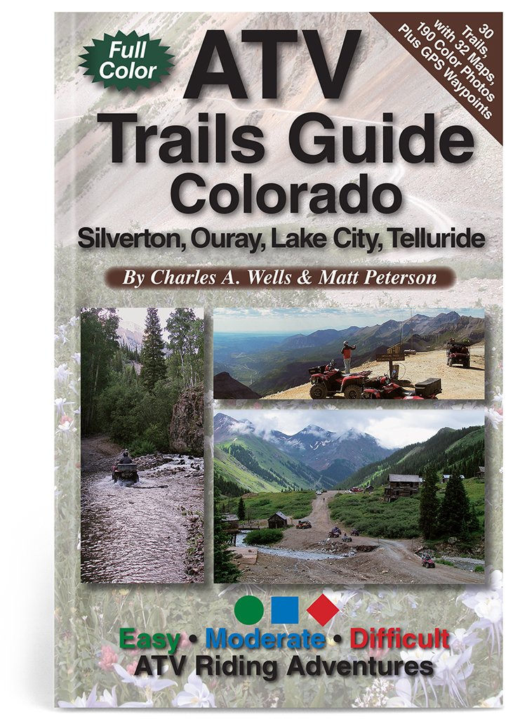
Top Picks & Comparison
| # | Product | Price | Rating | ||
|---|---|---|---|---|---|
| #1 | |
ATV Trails Guide Colorado Silverton, Ouray, Lake City, Telluride |
— | (122) | Check Price on Amazon → |
| #2 |  |
Ouray Hiking Guide: Favorite Hiking Trails of Ouray, Colorado |
— | (1) | Check Price on Amazon → |