San Juan Mountains ATV Trail Guide

Salem Hassan founded Travelcamp RV and brings 30+ years of hands-on RV, marine, and powersports retail experience to every review.
Why trust us
BestATVTrails trail guides are researched by riders with decades of powersports experience. Our lead researcher spent 30+ years in powersports retail and has ridden trails across a dozen US states. Every gear recommendation is sourced from real product research matched to specific terrain — not paid placements or generic affiliate lists.

San Juan Mountains ATV Trail Guide
Gear for This Trail

The San Juans reward preparation. We recommend gear that addresses altitude, sudden weather changes, rocky terrain, and the reality that help may be far away. The products below are widely available and fit the needs of this specific region well.
| Gear Type | Brand | Product | Why It Suits the San Juan Mountains | Approx. Price |
|---|---|---|---|---|
| Helmet | Bell | Qualifier Full-Face Helmet | A full-face design makes sense on exposed, rocky pass roads where weather can turn cold, wet, and windy fast. The Bell Qualifier offers good ventilation for lower climbs but more protection than an open-face option at high elevation. | $120-$180 |
| Protective Gear | Alpinestars | Bionic Action Chest Protector | On routes like Imogene or Engineer, rocky surfaces and off-camber sections make upper-body protection a smart upgrade. This protector adds chest and back coverage without feeling as bulky as some full motocross setups. | $130-$180 |
 Gloves Gloves |
Fox Racing | Dirtpaw Gloves | We like a durable glove with decent bar feel for long descents and cold morning starts. The Dirtpaw line is affordable, easy to replace, and offers enough padding and grip for rocky mountain riding. | $25-$40 |
| Terrain-Specific Navigation | Garmin | Tread Powersport GPS | Cell service is unreliable in remote San Juan drainages. A dedicated powersports GPS is one of the best trail-specific upgrades for this region, especially when linking towns, passes, and alternate routes. | $500-$700 |
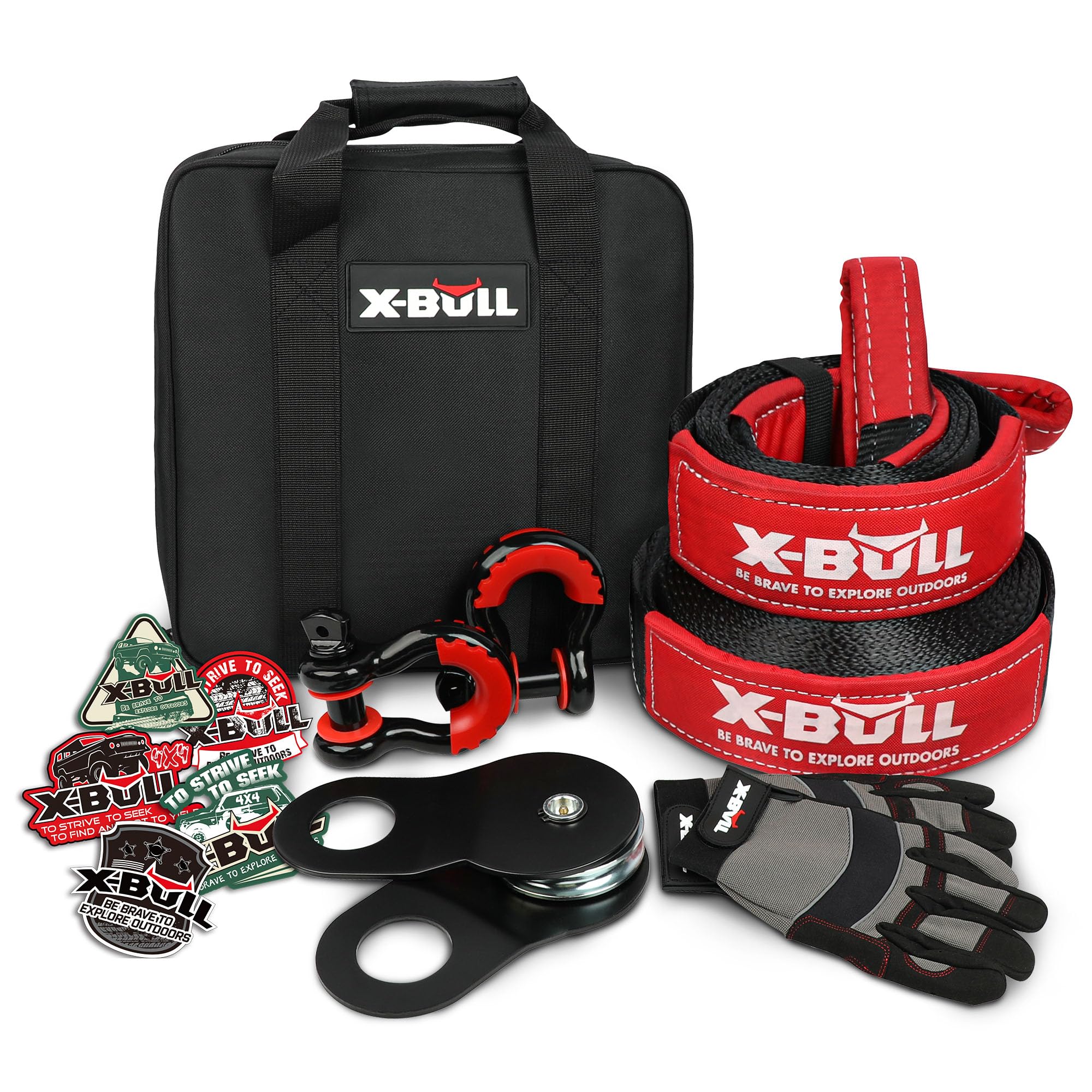
| Recovery / Utility | Rhino USA | Tow Strap Recovery Kit | Even if the route is mostly rock instead of mud, a strap is valuable when a machine breaks, slides into a rut, or needs help on a steep section. We recommend carrying recovery basics because many San Juan routes are remote and delays are common. | $35-$60 |
| Comfort / Utility | Nelson-Rigg | Hurricane Dry Duffle Bag | Afternoon storms are common in the San Juans, and we strongly prefer a waterproof bag for layers, tools, snacks, and emergency supplies. A dry duffle keeps insulation and electronics usable after rain or creek splash. | $70-$110 |
If we were building a San Juan-specific packing list beyond the table, we would also add a compact first-aid kit, tire plug kit, mini compressor, extra water, and an insulated rain layer. This is one of those places where a small gear mistake can become a big day.
Introduction
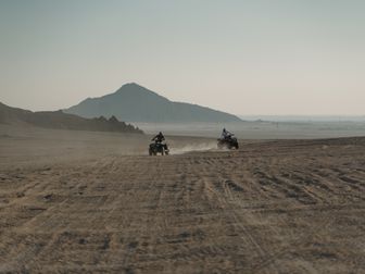
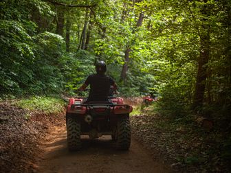
San Juan Mountains ATV trails are some of the most scenic and demanding high-country routes in Colorado. Riders come here for dramatic alpine basins, shelf roads cut into old mining routes, ghost towns, wildflower meadows, and a long list of famous passes linking towns like Ouray, Silverton, Lake City, and Telluride. This is not a casual trail system in the usual sense. The San Juans are a network of county roads, Jeep roads, OHV routes, and historic mining tracks that can take us from dense forest to exposed tundra in a matter of miles.
What makes this area special is the combination of scenery and seriousness. We get iconic routes like Engineer Pass, Cinnamon Pass, Imogene Pass, Ophir Pass, California Pass, Corkscrew Pass, and Black Bear Pass, all set above tree line with major elevation, loose rock, and weather that can turn quickly. Riders visit because few places in the West offer this many connected high-altitude routes in one region. If we plan carefully, respect closures and changing conditions, and bring the right machine and gear, the San Juans can deliver one of the best ATV adventures in the country.
Trail Overview

The San Juan Mountains do not operate as one single signed ATV park, so it helps to think of them as a broad interconnected backcountry riding region centered on the Alpine Loop and surrounding pass roads.
Key stats at a glance:
- Region: San Juan Mountains, Southwest Colorado
- Core riding areas: Ouray, Silverton, Lake City, Telluride, Ophir, Animas Forks
- Approximate rideable mileage: 250+ miles of commonly used ATV-accessible routes across the wider network, with the Alpine Loop itself covering roughly 65 miles depending on exact connectors
- Difficulty range: Green to Double-Black depending on route
- Elevation: Roughly 8,000 feet to over 13,000 feet
- Highest commonly ridden passes: Imogene Pass around 13,114 feet, Engineer Pass around 12,800 feet, Cinnamon Pass around 12,640 feet
- Permit requirements: Colorado OHV registration or permit required for off-highway use on eligible vehicles; county road legality depends on machine type and route
- Best season: Late June through late September in most years; July through early September is the most reliable window
- Nearest towns: Ouray, Silverton, Lake City, Telluride
The most popular basecamps are Ouray and Silverton for riders who want access to multiple famous passes in one trip. Lake City is ideal for easier access to Engineer and Cinnamon, while Telluride is a common launch point for Imogene and Ophir. Snowpack controls the season every year, so exact opening dates vary.
Trail Conditions & Terrain
The San Juans are defined by old mining roads, not groomed ATV trails. That means trail conditions can shift dramatically from one pass to the next and even from one mile to the next.
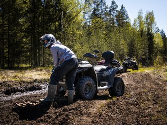
Expect a mix of hard-packed dirt, embedded rock, loose shale, broken scree, ledge steps, washouts, ruts, and narrow shelf-road sections. Lower elevations often start with forest roads and smoother gravel, but once we climb toward the major passes, the terrain usually gets rougher, steeper, and more exposed. Many routes are wide enough for Jeeps and side-by-sides, but width should not be confused with ease. A broad mining road can still have severe drop-offs, off-camber turns, and rockfall debris.
Engineer Pass and Cinnamon Pass are often considered the gateway routes for many ATV riders because they are famous, scenic, and generally less intimidating than the hardest passes. Even so, both can include loose climbs, water bars, baby-head rocks, and erosion damage after storms. California Pass, Hurricane Pass, and Corkscrew Gulch add more steep grades and loose surfaces, often in a loop from Silverton.
Imogene Pass is a major step up. It is high, rocky, and technical in sections, with narrow shelf-road exposure and sharp switchbacks. Ophir Pass is shorter but has loose rock and a shelf section that demands attention. Black Bear Pass is the route that gets the most attention online, and for good reason: it is extremely exposed, has very tight switchbacks above Telluride, and is not appropriate for most ATV riders. Conditions and legal access details can change, so we always recommend checking local ranger district, county, and town guidance before planning around it.
Creek crossings in the San Juans are usually shallow seasonal water crossings rather than deep mud bogs, but runoff can make them stronger early in the season. Afternoon storms can create standing water, slick rock, and fresh washouts. Mud is possible, but this region is more about rock, altitude, and exposure than swampy terrain.
One of the biggest factors here is elevation. Machines lose power at altitude, riders fatigue faster, and weather can swing from sun to sleet in a single afternoon. At 12,000 to 13,000 feet, even a moderate obstacle feels harder than it would at lower elevations.
Difficulty & Who It's For
Because the San Juan network includes everything from scenic county roads to highly exposed pass descents, it makes sense to rate individual routes rather than the whole region with one number.
Green: Easy Scenic Roads
Best for: beginners with some machine familiarity, families, and riders focused on views over obstacles.
Green-level sections are generally lower-elevation forest roads, graded connectors, and smoother access roads near trailheads and towns. Some roads around Lake City and lower connectors near Silverton can fit this category in dry conditions. These are best for riders who want a taste of the San Juans without committing to major pass exposure.
Blue: Intermediate Alpine Routes
Best for: riders with prior mountain trail experience and confidence on loose rock and moderate grades.
We place much of Cinnamon Pass and easier approaches to Engineer Pass in the Blue category when conditions are favorable. These routes still require focus, ground clearance, and throttle control, but they are realistic goals for many ATV riders who have already done rocky Western trails.
Black: Advanced High-Pass Riding
Best for: experienced riders comfortable with shelf roads, steep climbs, rocky descents, and altitude.
Imogene Pass, rougher sections of Engineer Pass, and some linked routes near California/Hurricane/Corkscrew can ride Black depending on weather and trail damage. Exposure, loose switchbacks, and technical rock move these beyond casual riding. We recommend these routes for riders with solid line choice, braking discipline, and mountain judgment.
Double-Black: Expert Only
Best for: highly experienced riders who fully understand the consequences of exposure and rapidly changing mountain conditions.
In this region, Black Bear Pass is the route most often associated with Double-Black difficulty. The challenge is not just surface roughness. It is the combination of narrow shelf road, severe exposure, descending switchbacks, traffic, and high consequence for mistakes. For many ATV riders, the correct decision is to skip it.
Permits & Access
Colorado access rules can be confusing in the San Juans because riders may move between OHV trails, county roads, Forest Service roads, and town access routes in the same trip.
Colorado OHV registration and permits
For ATVs and other off-highway vehicles used on public OHV routes in Colorado, we generally need either:
- a Colorado OHV registration for Colorado residents, or
- a Colorado OHV permit for nonresidents.
Pricing can change, but the cost is typically around $25-$30 for the season. The permit year usually runs from April 1 through March 31. We recommend buying directly through Colorado Parks and Wildlife or approved vendors in gateway towns like Ouray, Silverton, and Lake City.
Street-legal and county road considerations
Some San Juan routes connect through county roads or towns where street legality matters. Not every ATV is legal on every connecting road. Rules vary by county and municipality, and some communities have designated OHV-friendly access while others do not. Before assuming a route is fully rideable from town, check local rules for:
- Ouray County
- San Juan County
- Hinsdale County
- San Miguel County
- town-specific access in Silverton, Lake City, and Telluride area approaches
Parking and staging
Common staging options include:
- Ouray area trailheads and county-road pullouts
- Silverton OHV-friendly lodging and trailer parking areas
- Lake City trail access points for Alpine Loop travel
- Animas Forks area access, depending on road conditions and vehicle type
Parking availability changes by season and weather. In peak summer, town staging fills early. We recommend confirming trailer parking with lodging or local visitor centers before arrival.
Reservation requirements
In general, there is no standard reservation system for riding the pass roads themselves. However, if we plan to camp in developed campgrounds, reserve a jeep tour shuttle, or stay at OHV-friendly lodging, reservations may be needed in peak season.
Tips for Riding This System
- Start early every day. In the San Juans, afternoon lightning and rain are common. We try to be over the highest passes before storms build.
- Do not underestimate altitude. Riders from low elevation may feel fatigued, dehydrated, or lightheaded. Drink more water than usual and keep the first day conservative.
- Plan fuel carefully. Distances between towns are manageable on paper, but side trips, low-range climbing, and detours increase consumption. Top off whenever possible in Ouray, Silverton, Lake City, or Telluride access points.
- Check current pass status locally. Snowfields, washouts, rockslides, and temporary closures can change a route overnight. Ranger districts, county updates, and local shops are the best sources.
- Ride within sight lines on shelf roads. Blind corners, rental Jeeps, SxSs, and mountain bikers all use portions of this network. Keep speed conservative on exposed roads with limited passing room.
- Bring layers even on bluebird mornings. A sunny 8 a.m. start can turn into sleet at 13,000 feet. Waterproof outerwear and dry gloves matter here.
- Know when to turn around. In the San Juans, weather, traffic, or a rider’s comfort level can make retreat the smartest move. There is no shame in skipping the hardest pass.
FAQ
Are the San Juan Mountains good for beginner ATV riders?
Yes, but only on selected routes. The wider region includes easier scenic roads and moderate passes, but many of the famous routes are advanced because of rock, exposure, and altitude. We recommend beginners stick to easier connectors near Lake City or lower forest roads before attempting major passes.
What is the best base town for riding San Juan Mountains ATV trails?
Silverton is the most central base for many iconic loops, especially if we want access to Cinnamon, Engineer, California, Hurricane, and Corkscrew. Ouray is excellent for riders targeting Imogene and Engineer. Lake City is a strong choice for a slightly calmer launch point.
Do we need a street-legal ATV in the San Juans?
Sometimes. A Colorado OHV permit or registration covers off-highway use, but some route connections use county roads or town streets where local rules may require street legality or may restrict ATV travel entirely. We recommend checking county and town rules for the exact route we plan to ride.
When do the high passes usually open?
In average years, many major routes begin opening from late June into July, with the most dependable riding window running through September. Heavy snow years can delay openings significantly, and early storms can close passes again in fall.
The San Juans are one of the crown jewels of Western ATV riding. If we approach them with realistic route selection, strong weather awareness, and the right gear, they offer unforgettable alpine travel through some of Colorado’s most iconic mountain terrain. For riders researching the best San Juan Mountains ATV trails, the smartest strategy is simple: pick a base town, match the pass difficulty to our skill level, and leave room in the schedule for the mountains to make the final decision.
Get our best guides in your inbox
Top Picks & Comparison
| # | Product | Price | Rating | ||
|---|---|---|---|---|---|
| #1 | |
X-BULL Off-Road 4×4 Recovery Kit - Heavy Duty 3'' x 30' (31518LBS) 100% Nylon Tow Strap+41887lbs Break Strength D-Ring Shackles (2pcs)+Block Pulley+Gear Storage Bag +Gloves for ATV/UTV Jeep Truck |
$102.90 | (16) | Check Price on Amazon → |
| #2 |  |
1" x30ft Kinetic Recovery Rope (48,500lbs) – Heavy Duty Recovery Kit with Tow Strap, 2 Soft Shackles (7/16"x22"), Off-Road Shovel & Carry Bag – Ideal for Trucks, SUVs, ATVs, UTVs |
$59.95 | (117) | Check Price on Amazon → |
| #3 |  |
VEVOR Off-Road Recovery Kit, 3" x 30' Tow Straps Heavy Duty with Hooks 30,000 lbs Winch Strap Kit, 44092 lbs D-Ring Shackles, Shackle Receiver, Snatch Block Pulley, Gloves, Storage Bag for ATV Jeep |
$94.90 | (252) | Check Price on Amazon → |
| #4 | 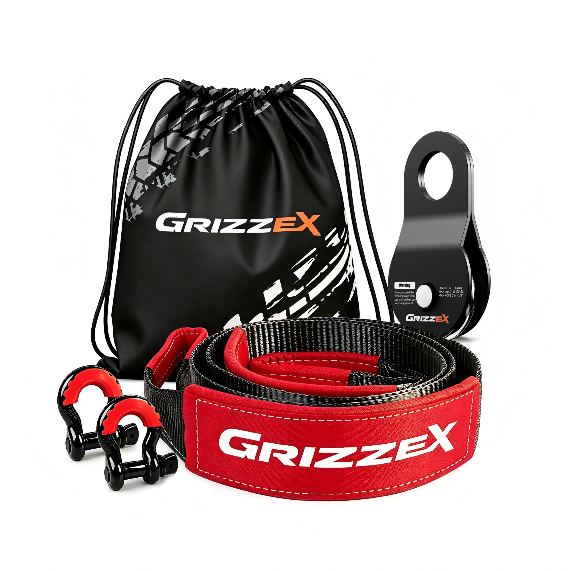 |
Off-Road Recovery Kit, 3" x 8' Tree Saver Strap, 8.8T Forged Snatch Block, 3/4" D-Ring Shackles 2 Pack, Storage Bag, Heavy Duty Recovery Gear for Jeep Truck SUV UTV ATV Trailer |
$39.90 | (8) | Check Price on Amazon → |
| #5 |  |
Offroad Recovery Kit, 3" x 30 ft Tow Recovery Strap, 1pcs 8T Heavy Duty Snatch Block Pulley, 2pcs 3/4" D-Ring Shackles with Storage Bag for Truck Jeep SUV ATV |
$42.99 | (15) | Check Price on Amazon → |