Taos Area ATV Trail Guide

Ellen Kietzmann brings more than 25 years of senior leadership in the RV and outdoor recreation industry. She spent 22 years at Blue Ox — rising from Vice President of Sales & HR to President — where she grew the deal…
Why trust us
BestATVTrails trail guides are researched by riders with decades of powersports experience. Our lead researcher spent 30+ years in powersports retail and has ridden trails across a dozen US states. Every gear recommendation is sourced from real product research matched to specific terrain — not paid placements or generic affiliate lists.

Taos Area ATV Trail Guide
Gear for This Trail

High-elevation riding around Taos calls for gear that handles dust, sudden rain, rocky impacts, and navigation challenges. We recommend focusing on protection, route-finding, and emergency self-sufficiency.
| Gear Type | Brand | Product | Why It Suits Taos-Area Riding | Approx. Price |
|---|---|---|---|---|
 Helmet Helmet |
Bell | Bell Qualifier DLX MIPS Helmet | Good ventilation for long summer climbs, MIPS impact protection, and a face shield that helps with dust and cold morning air on high-elevation roads. | $230-$300 |
| Protective Gear | Alpinestars | Bionic Action Chest Protector | Useful on rocky forest routes where branches, roost, and handlebar impacts are real concerns. Lightweight enough for active mountain riding. | $130-$180 |
| Gloves | Fox Racing | Dirtpaw Gloves | Affordable, durable gloves with decent knuckle coverage and grip for rough bars, cooler mornings, and mixed wet/dry conditions. | $25-$35 |
| Terrain-Specific Item | Garmin | Tread Powersport GPS | Taos-area riding often involves dispersed forest roads and route decisions. A dedicated powersports GPS helps with navigation, tracking, and staying on legal motorized routes. | $500-$700 |
| Recovery / Utility | Rhino USA | Recovery Tow Strap 3" x 20' | Smart insurance for mud pockets, off-camber pullouts, or helping another machine on steep mountain roads where cell service may be weak. | $35-$50 |
| Comfort / Utility | Kemimoto | UTV/ATV Waterproof Rear Cargo Bag | Mountain weather changes quickly, and a waterproof storage bag is ideal for layers, snacks, tools, and rain gear on long scenic rides. | $70-$110 |
If your machine sees a lot of rocky trail use, we also suggest checking whether a model-specific Ricochet Off-Road skid plate set is available for your ATV. That is one of the best upgrades for repeated riding on embedded rock and drainage ledges common in northern New Mexico.
Introduction
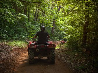
Taos New Mexico ATV trails offer a very different ride from the desert routes many riders picture when they think about the Southwest. Around Taos, we found a mix of high-elevation forest roads, rugged two-track, old logging routes, and mountain passes that climb into cooler air with wide views of the Sangre de Cristo Mountains. Riders come here for the scenery as much as the trail time: dense pine and aspen stands, meadows, creek drainages, and long ridge sections that feel far removed from town.
The Taos area is best approached as a network of roads and trails spread across Carson National Forest and nearby public land rather than one single enclosed OHV park. Popular riding zones include Forest Road 76 toward Cabresto Lake, the trails and roads around Red River and Questa, and high-country routes that connect campgrounds, trailheads, and overlooks. For ATV riders who enjoy elevation changes, cooler summer temperatures, and scenic mountain terrain, Taos is one of northern New Mexico's most rewarding destinations. The tradeoff is that conditions can change fast, and planning matters more here than on lower-elevation trail systems.
Trail Overview

The Taos area does not function as one signed, mileage-posted ATV system with a single gate. Instead, riders typically explore a collection of legal Forest Service roads, designated motorized routes, and connecting mountain trails in the Carson National Forest near Taos, Questa, Red River, and Cabresto.
Key stats for Taos-area riding:
- Estimated rideable mileage: 100+ miles of legal motorized routes in the broader Taos/Questa/Red River zone, depending on seasonal openings and route selection
- Difficulty range: Green to Black, with some short expert-style obstacles or exposure that can feel near Double-Black in poor conditions
- Elevation range: Roughly 7,000 to over 10,500 feet depending on route
- Nearest town: Taos, New Mexico
- Popular staging areas: Cabresto Lake area, Red River area trailheads, Questa-side forest access points
- Permit requirement: No general day-use trail permit for most Carson National Forest roads, but vehicles must be street legal where required or properly registered for OHV use under New Mexico law
- OHV registration/sticker: New Mexico OHV registration is generally required for off-highway vehicles; out-of-state riders should verify current reciprocity rules with New Mexico OHV Program before traveling
- Best season: Late June through early October in most high-country areas, with July to September offering the most reliable access
- Reservations: Usually not required for trail access, but campground reservations may apply at developed sites
One of the best-known rides in the region is the route toward Cabresto Lake via Forest Road 134/76 corridor access, where riders get a classic northern New Mexico mountain experience with forest cover, steady climbs, and excellent scenery. Routes around Red River often add more elevation and tourism infrastructure, while Questa-side access can feel quieter and more backcountry-oriented.
Trail Conditions & Terrain
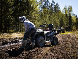
Taos-area terrain is defined by mountain variability. We researched routes that can begin on relatively smooth forest roads and quickly transition to embedded rock, loose gravel, ruts, and narrow shelf-style sections. The surface is commonly a mix of hard-packed dirt, decomposed granite, scattered baby-head rock, and occasional mud pockets after summer monsoon storms.
On lower and mid-elevation roads, riders can expect graded forest road segments that are manageable for most stock utility ATVs and side-by-sides. These roads often have washboarding, loose corners, and drainage humps, but they provide a good warm-up and access to more technical spurs. As the routes climb, the terrain usually becomes rougher. You may run into:
- exposed rock ledges
- steep switchbacks
- rain ruts
- loose climbs with rolling rock
- standing water in shaded sections
- downed branches or storm debris
- narrow stretches with drop-off exposure
Creek crossings are not the defining feature here the way they are in some eastern trail systems, but small water crossings, seep areas, and runoff channels do appear, especially after rain or during spring melt. In monsoon season, a dry section in the morning can become muddy and slick later in the day.
The biggest challenge for many riders is the grade and elevation. Long climbs can tax smaller-displacement machines, and descending steep rocky roads requires controlled braking and line choice. At over 9,000 feet, machines can feel a little softer on power, and riders who are not acclimated may feel the altitude too. Cooler temperatures are a major advantage in summer, but they can be misleading: weather changes quickly, and afternoon storms are common.
Vegetation also shapes the ride. Forested sections provide shade and a scenic tunnel effect, especially in mixed pine and aspen zones, while open meadows and ridge roads expose riders to wind and panoramic views. In the fall, the aspen color can make these routes especially attractive, though that season can also bring colder mornings and early snow risk.
Difficulty & Who It's For
Because the Taos area includes everything from easier forest roads to rocky mountain connectors, we recommend thinking about the region by route type rather than assigning one blanket rating.
Green
Best for: beginners, families, newer ATV riders, and riders on stock utility quads who want scenery without major technical features.
Green-level riding in the Taos area usually means wider forest roads near staging areas, maintained access roads, and lower-angle climbs. These routes still require attention because of washboard, loose gravel, and changing weather, but they are generally suitable for riders with basic off-road experience.
Blue
Best for: intermediate riders comfortable with loose climbs, moderate rock, and mountain-road exposure.
This is where much of the Taos-area riding falls. Blue sections often include steeper grades, rougher drainage crossings, moderate ruts, and occasional shelf-road feel. Riders should be comfortable standing on the pegs, controlling speed on descents, and choosing lines through rocky patches.
Black
Best for: experienced riders on well-maintained machines who are comfortable with technical mountain terrain.
Black-level routes or segments can include sustained rock, tighter switchbacks, off-camber turns, erosion damage, and more serious consequences for mistakes due to exposure or remoteness. Wet weather can push a Blue route into Black territory fast.
Double-Black
Best for: highly experienced riders only, and usually only in isolated conditions rather than formal trail ratings.
The Taos area is not a bike park with signed Double-Black ATV loops, but some steep, eroded, storm-damaged, or poorly maintained spurs can feel expert-only. If a route is washed out, blocked by timber, or deeply rutted, we recommend turning around rather than forcing a machine through a bad line at altitude.
Permits & Access
Access in the Taos area depends on where you ride, because most routes are spread across Carson National Forest rather than a single managed OHV fee area.
Parking and staging
Common staging options include pull-offs and developed recreation areas near Cabresto Lake access roads, Red River-area forest entries, and Questa-side trail access points. Parking availability varies by season and road condition. On busy summer weekends, developed lots can fill early, especially near campgrounds and fishing areas.
Permit costs
For most dispersed motorized route riding on Carson National Forest roads, there is typically no separate trail permit fee just to ride. However, some developed recreation sites may charge day-use or camping fees. If you plan to use a campground or developed picnic area as your base, check Recreation.gov or the relevant Forest Service district page.
Reservation requirements
Trail reservations are generally not required. Campground reservations may be required or recommended during peak summer and fall color season.
OHV sticker requirements
New Mexico regulates OHVs through the state OHV program. Riders should expect the following:
- New Mexico residents generally need current OHV registration for eligible machines.
- Out-of-state riders should verify whether their home-state registration qualifies under reciprocity rules.
- Youth safety requirements and helmet requirements may apply under state law.
- Spark arrestors and sound compliance may be required on public land routes.
Important access note
Before riding, we strongly recommend checking:
- Carson National Forest Motor Vehicle Use Map (MVUM)
- district closure notices
- fire restrictions
- monsoon storm damage updates
- seasonal gate closures
In this part of New Mexico, a route that looks open on a generic map may not be legally open to motorized use. The MVUM is the best starting point for legal route confirmation.
Tips for Riding This System
Start earlier than you think you need to. Afternoon thunderstorms are common in the mountains, and early starts give you better trail conditions, cooler temperatures, and more time to reroute if a road is blocked.
Download maps before you lose service. Cell coverage gets unreliable quickly outside town. We recommend having the Carson National Forest MVUM plus an offline map app or dedicated GPS.
Respect altitude for both machine and rider. Power can feel reduced above 9,000 feet, and riders from lower elevations may fatigue faster. Hydrate more than usual and pace technical climbs.
Plan for temperature swings. A sunny Taos morning can still be chilly at elevation, and storms can drop temperatures fast. Pack a waterproof layer even if the forecast looks mild.
Watch for mixed traffic. Many Taos-area routes are shared with full-size 4x4s, hunters in season, hikers near trailheads, and anglers around lake access roads. Blind corners deserve extra caution.
Do not underestimate monsoon damage. Summer rain can cut deep ruts and wash out familiar lines. If a section looks freshly eroded or unstable, turn back rather than forcing it.
Fuel up in town. Services are concentrated around Taos, Questa, and Red River. Once you are in the forest, fuel, water, and repair support are limited.
FAQ
Are there designated ATV trails right in Taos?
Not in the sense of one centralized ATV park. Most Taos-area riding happens on legal Forest Service roads and designated motorized routes in Carson National Forest near Taos, Questa, and Red River.
What is the best trail area near Taos for scenic mountain riding?
The Cabresto Lake and Questa/Red River zones are among the most scenic. They combine forest cover, elevation gain, and big mountain views that make the Taos area stand out.
Do I need a permit to ride ATV routes near Taos?
Usually there is no separate trail-use permit for general forest road riding, but your ATV must meet New Mexico OHV registration requirements where applicable, and you should confirm route legality on the Carson National Forest MVUM.
When is the best time to ride Taos New Mexico ATV trails?
Late June through early October is typically the best window. Snow can linger well into early summer at higher elevations, and fall can bring excellent scenery but also early cold and changing access.
Taos is one of the most scenic mountain riding regions in New Mexico, but it rewards riders who plan carefully. With legal route research, weather awareness, and the right gear, the Taos area can deliver a memorable mix of alpine forest roads, cooler temperatures, and classic high-country ATV scenery. For riders looking beyond desert terrain, this corner of northern New Mexico deserves a serious look.
Get our best guides in your inbox
Top Picks & Comparison
| # | Product | Price | Rating | ||
|---|---|---|---|---|---|
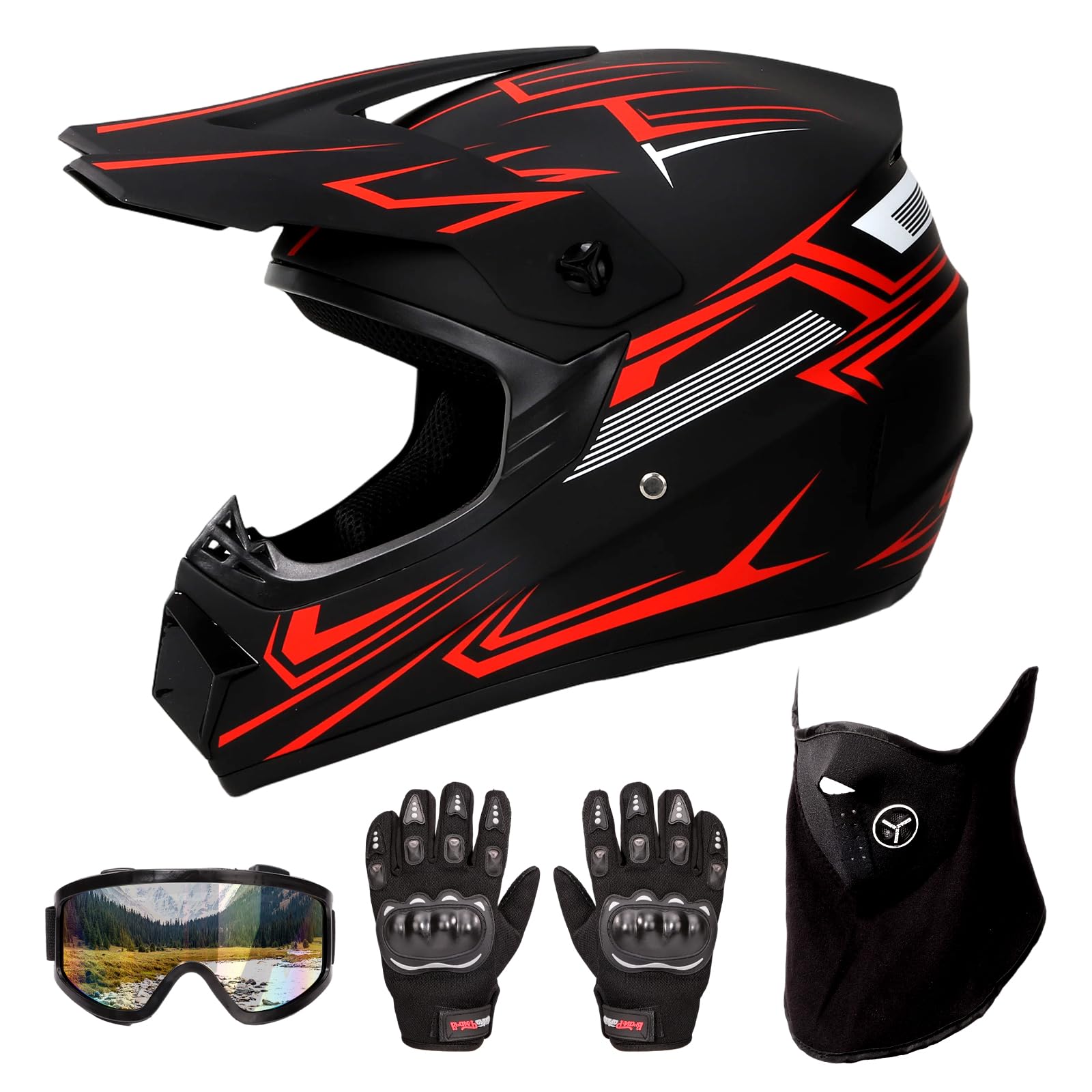
| #1 | |
Motocross Helmet, DOT Approved Dirt Bike Helmet for Off-Road Riding Trail Riding Endurance Racing |
$65.99 | (6) | Check Price on Amazon → |
| #2 |  |
SuperATV Ultimate Tool Kit for UTV and ATV | 8, 10, 12, 13, 14, 15, 16, 17, 18, 19, 21 mm Sockets and Bits |
$317.88 | (26) | Check Price on Amazon → |
| #3 |  |
Fly Racing Patrol Off-Road Gear Set - (Over the Boot) Pant and Jersey for MX, ATV and Off-Road Riding |
$224.89 | (2) | Check Price on Amazon → |