Paiute ATV Trail System: Complete Riding Guide

Alana Azzouz is a Senior Editor at Searchshop Media Network with over a decade of experience in consumer content quality and editorial standards. She has reviewed thousands of product guides, buying articles, and comp…
Why trust us
BestATVTrails trail guides are researched by riders with decades of powersports experience. Our lead researcher spent 30+ years in powersports retail and has ridden trails across a dozen US states. Every gear recommendation is sourced from real product research matched to specific terrain — not paid placements or generic affiliate lists.
Paiute ATV Trail System: Complete Riding Guide
Gear for This Trail

For the Paiute system, we recommend gear that addresses long mileage, changing weather, altitude, dust, and self-sufficiency between towns. A short local trail setup is not enough here. Riders need protective equipment, navigation, and a few comfort items that make multi-day travel easier.
| Gear Type | Brand | Product | Why It Suits This Trail | Approx. Price |
|---|---|---|---|---|
 Helmet Helmet |
Bell | Qualifier Full-Face Helmet | A full-face helmet makes sense on Paiute because riders deal with dust, cold morning air at elevation, and long transfer miles. The Qualifier is a widely available option with good ventilation and a face shield for changing conditions. | $120-$180 |
| Gloves |
Fox Racing | Dirtpaw Gloves | These work well for a big trail system where riders need grip, light protection, and comfort over full days. They are a practical choice for dusty bars, cooler mornings, and repeated braking on long descents. | $25-$40 |
| Upper-body protection | Alpinestars | Bionic Action Chest Protector | On rocky mountain routes with loose surfaces and the possibility of washouts, chest and back protection is worth carrying. This model is lightweight enough for trail use without feeling like full moto race armor. | $130-$180 |
| Navigation / terrain-specific item | Garmin | Tread Powersport Navigator | Paiute is exactly the kind of network where GPS matters. With multiple towns, connectors, and side loops, a powersports-specific GPS helps riders stay on route and manage long-distance navigation when cell service fades. | $500-$700 |
| Recovery / utility item | Rhino USA | Recovery Tow Strap | Long gaps between services make a tow strap one of the smartest items to pack. If a machine breaks, gets stuck in mud after a storm, or loses drive on a climb, a strap can save a very long delay. | $30-$45 |
| Comfort / utility item | Tusk | UTV/ATV Handlebar Bag | For a multi-day system, quick-access storage matters. A compact bar bag or front storage bag is useful for snacks, maps, tools, registration papers, and extra gloves without opening larger cargo every stop. | $25-$50 |
If your machine allows it, we also recommend carrying a tire repair kit, mini compressor, spare belt for belt-driven machines, and extra water beyond what you would usually bring on a short ride.
Introduction
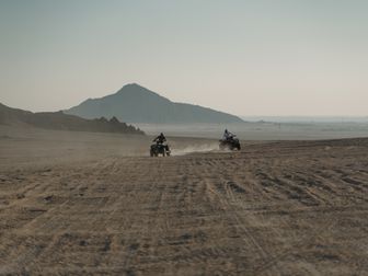
The Paiute ATV trail system is one of the most famous off-road destinations in Utah, and for good reason. Sprawling across central Utah with roughly 900 miles of connected trails and side routes, it gives ATV and UTV riders the rare chance to build anything from a half-day scenic loop to a full multi-day backcountry trip between mountain towns. Riders come here for the scale, but they return for the variety: alpine overlooks, dense aspen groves, open meadows, lava rock, canyon country, and long ridge sections that feel remote even when the next fuel stop is still reachable.
We recommend the Paiute system to riders who want more than a single trailhead experience. This network links towns like Marysvale, Circleville, Junction, Beaver, and Richfield through signed routes and connector trails, which makes it one of the best destination systems in the country for trail-based travel. The scenery changes dramatically with elevation, and so do the riding conditions. That means smart planning matters here, especially because services can be far apart and weather can shift fast in the mountains.
Trail Overview

The Paiute Trail is best thought of as a large regional OHV network rather than a single point-to-point trail. The main system is commonly cited at over 2,000 miles when all connected side trails and routes are included, but many riders planning a core trip focus on the roughly 900-mile primary riding system and major loops that connect the central sections.
Key Stats
- Total mileage: About 900 miles for the core system; over 2,000 miles including connected side trails and spurs
- Location: Central Utah, primarily around Marysvale and the Fishlake National Forest region
- Difficulty range: Green to Black, with a few more technical segments and side routes approaching Double-Black conditions in poor weather or on rough connectors
- Elevation: Roughly 5,000 feet to over 11,000 feet, depending on route and season
- Permit requirements: Utah non-street-legal OHVs need a Utah OHV permit unless exempt; street-legal machines follow registration rules
- Best season: Late June through early October for the highest routes; lower sections may open earlier depending on snowpack
- Nearest trail towns: Marysvale is the best-known base, with access also from Circleville, Junction, Beaver, Richfield, Salina, and several other communities
Marysvale is the most common launch point because it has lodging, food, fuel, repair access, and direct connections into multiple loops. For riders who want to string together several days, that town is usually the easiest place to start and resupply.
Trail Conditions & Terrain
The Paiute system covers a huge range of terrain, which is one reason it appeals to both newer riders and experienced backcountry groups. Surface conditions vary by elevation, traffic, recent grading, and summer monsoon weather.
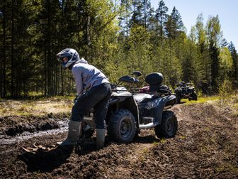
On many of the main signed routes, we found a mix of hard-packed dirt, decomposed gravel, loose rock, forest two-track, and shelf-road style mountain sections. Lower elevations can feel dry, dusty, and fast, especially in midsummer. Higher sections often hold moisture longer and can become slick after storms, with muddy corners, ruts, and embedded rock showing up where riders may not expect them.
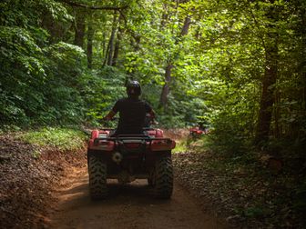
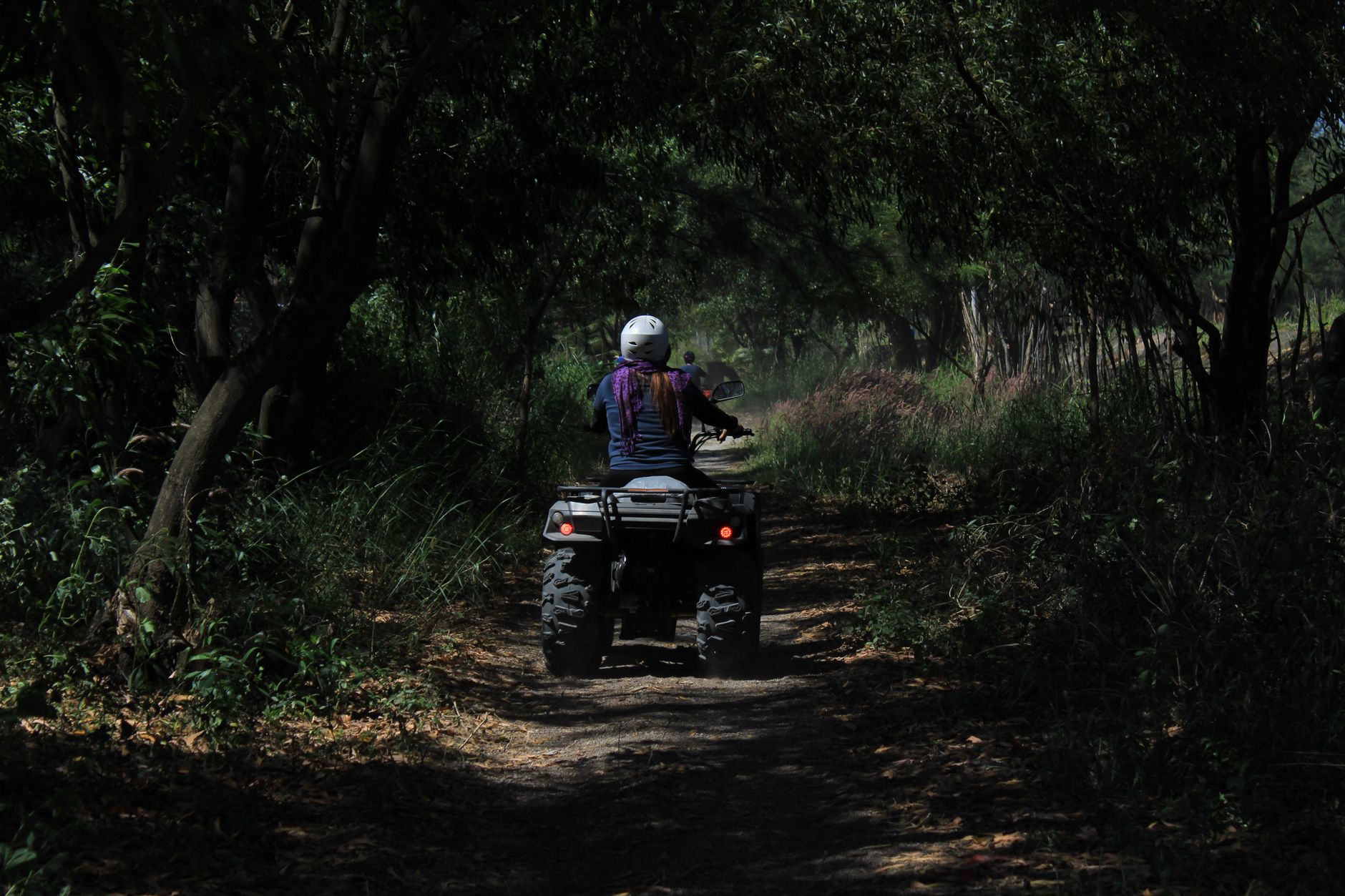
Aspen and pine forest sections are common near Fishlake-area connectors and high mountain loops. These areas usually ride smoother than the rockier volcanic or lower desert sections, but roots, washouts, and braking bumps can still build up by late season. In open country, riders should expect long climbs and descents, occasional switchbacks, loose baby-head rock, and exposed ridgelines where weather can move in quickly.
Some of the best-known rides in the system include the Bullion Canyon area, Mineral Mountains routes, and loops that connect through Marysvale Canyon and toward Circleville. Bullion Canyon is especially popular for scenery and mining history, but conditions can change with runoff and traffic. In higher zones, snowmelt can leave wet patches and erosion damage well into early summer.
Creek crossings are not the defining feature of Paiute the way they are on some eastern trail systems, but riders may still encounter small water crossings, runoff channels, drainage dips, and storm-cut wash sections. The bigger challenge here is usually not water depth but distance, elevation, and surface variability. One hour you may be cruising a broad graded road, and the next you are climbing a rough, narrow mountain track with loose stone and steep exposure.
Dust is a major factor in dry periods. On holiday weekends and peak summer dates, visibility can drop quickly behind other groups. We recommend spacing out and carrying extra eye protection. Mud can also become a serious issue after monsoon storms, especially on clay-heavy stretches where traction falls off fast.
Difficulty & Who It's For
Because the Paiute system is so large, it is more useful to rate it by route type than by one overall number. Most riders can enjoy some part of this network, but not every section fits every skill level.
Green
Who it suits: Beginners, families, casual sightseers, and riders on utility ATVs looking for scenic forest-road travel.
Many main connectors near town access points and maintained forest roads fall into the Green category. These routes are generally wider, less steep, and easier to navigate. Riders still need to manage dust, altitude, and long distances, but the technical riding demands are relatively low.
Blue
Who it suits: Intermediate riders, vacation groups, and most recreational ATV riders.
A large share of the Paiute system rides as Blue because of loose gravel, moderate climbs, occasional ruts, and changing surface conditions. This is the sweet spot for the system. Riders should be comfortable standing through rough patches, controlling speed on descents, and handling occasional rock gardens or washouts.
Black
Who it suits: Experienced riders with mountain trail experience and solid route-planning habits.
Black-rated sections tend to include steeper grades, rougher rock, narrower trail, more exposure, and less forgiving surfaces after storms. High-elevation weather can quickly turn a manageable route into a much more demanding one. Fuel planning and navigation also become more important on these longer, less convenient segments.
Double-Black
Who it suits: Advanced riders only, usually on selected side trails, rough connectors, or routes made difficult by weather.
The Paiute system is not primarily known as an extreme rock-crawling destination, but some side routes, washed-out climbs, and remote technical connectors can feel Double-Black when conditions deteriorate. We would not send newer riders onto remote advanced sections without a group, a map, and recovery gear.
Permits & Access
The Paiute system is spread across public land, forest roads, and designated OHV routes, so access logistics matter.
Parking and Trailheads
Marysvale is the main jumping-off point, and many riders stage from local lodging that allows trailer parking. There are also access points near Circleville, Junction, Beaver, Richfield, and other trail towns with local staging options, fuel, and direct route entry. Because the system is designed around trail-town connectivity, many riders unload once and ride from town for several days.
Permit Costs
Utah requires OHV registration or permits for many machines using public trails. For non-resident, non-street-legal OHVs, Utah typically requires a non-resident OHV permit, commonly around $30 for 12 months, though riders should verify the current fee before travel through Utah State Parks or the Utah OHV program. Resident requirements differ based on registration status.
Reservation Requirements
There is generally no trail reservation system for riding the Paiute network itself. However, if you plan to camp in developed campgrounds, book lodging in Marysvale, or travel on holiday weekends, reservations for accommodations are strongly recommended. Peak summer weekends can get busy.
OHV Sticker Requirements
- Utah residents: Need current Utah OHV registration if the machine is not street legal and is operated where OHV registration applies.
- Non-residents: Usually need a Utah non-resident OHV permit for non-street-legal machines.
- Street-legal ATVs/UTVs: Must meet Utah street-legal requirements if using roads where that status is required.
Rules can change, and local route legality may differ between dirt routes, county roads, and town connectors. We recommend checking current Utah State Parks OHV rules and local county guidance before your trip.
Tips for Riding This System
Plan fuel stops before you unload. The Paiute system is famous for long-distance connectivity, but that also means long distances between services on some loops. Know your machine's real-world range, not just the brochure number.
Start earlier than you think you need to. Afternoon storms are common in mountain country. An early start gives you better traction, cooler temperatures, and more margin if a route takes longer than expected.
Download maps before you lose service. Cell coverage can be unreliable in the high country and remote connectors. A dedicated GPS or offline map app is one of the best investments for this trail system.
Dress for two seasons in one day. Morning temperatures at elevation can feel cold even in midsummer, while lower sections may be hot and dusty by afternoon. Layering works better than one heavy jacket.
Watch weather before committing to high routes. Some upper sections stay snowbound later than expected, and monsoon rain can quickly turn easy roads into slick, rutted climbs.
Respect trail-town speed limits and access rules. One of Paiute's biggest advantages is town-to-trail riding. That access depends on riders following local road rules, staying on designated routes, and being courteous in communities.
Carry more water than you use on local rides. Altitude, sun, and long mileage add up fast here. Dehydration sneaks up on riders who are used to shorter, lower-elevation day trips.
FAQ
How long does it take to ride the Paiute ATV Trail System?
You can sample it in a day from Marysvale, but most riders need 3 to 5 days to experience several major loops without rushing. A full exploration of the broader system can take much longer.
Is the Paiute Trail beginner friendly?
Yes, parts of it are. There are many Green and Blue routes suitable for newer riders, especially near major access towns. However, the full system also includes steeper, rougher, and more remote sections that are better for experienced riders.
Do I need a permit to ride the Paiute Trail if I am from out of state?
In most cases, yes if your ATV or UTV is not street legal. Non-resident riders usually need a Utah non-resident OHV permit. Check the current Utah OHV rules before your trip because fees and requirements can change.
What is the best town to stay in for the Paiute system?
Marysvale is the most popular base because it has direct trail access, lodging, food, and fuel. It is the easiest place for many riders to start a multi-day trip, though towns like Circleville, Beaver, and Richfield can also work depending on your route plan.
Get our best guides in your inbox
Final Take
The Paiute system earns its reputation because it offers something rare: true trail travel on a huge, scenic network where riders can move between mountain towns, climb into alpine country, and build a trip that fits their skill level. We recommend it most for riders who enjoy planning routes, covering real miles, and mixing sightseeing with backcountry self-sufficiency.
If you prepare for elevation, weather, fuel range, and navigation, the Paiute ATV Trail System can be one of the best multi-day ATV adventures in the American West.
Top Picks & Comparison
| # | Product | Price | Rating | ||
|---|---|---|---|---|---|
| #1 | |
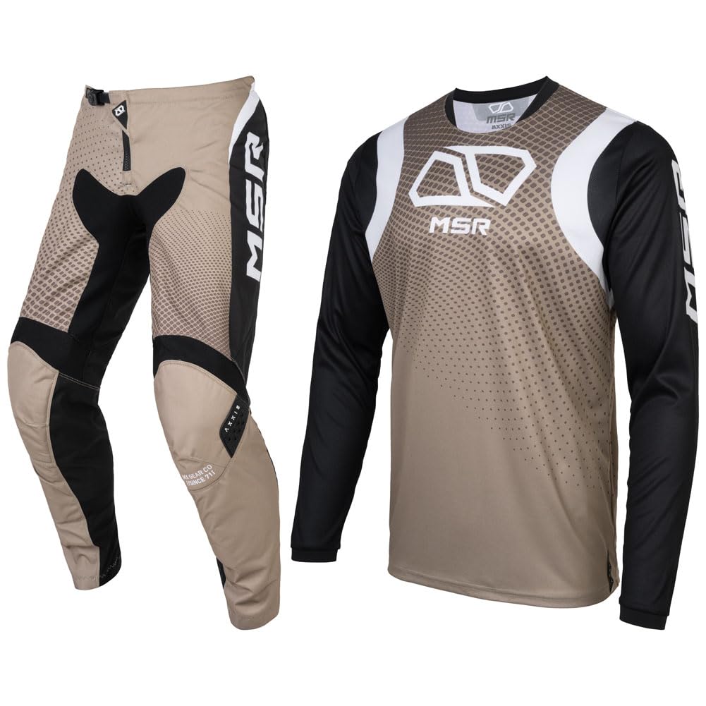
MSR Axxis Proto Dirt Bike, Motocross Jersey and Pant Combo |
$94.98 | (17) | Check Price on Amazon → |
| #2 | |
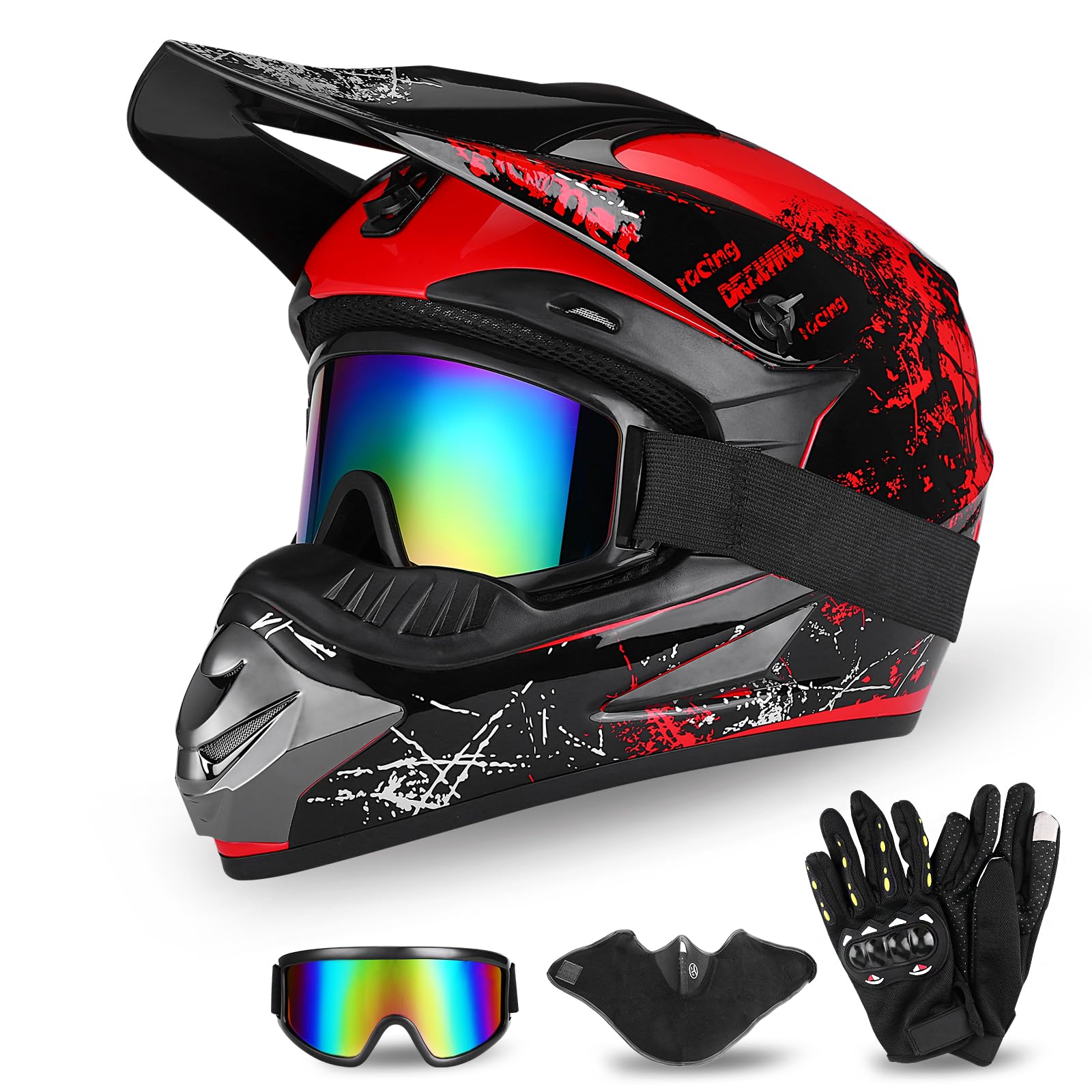
Full Face Dirt Bike Helmet DOT Certified - Complete Adult ATV Helmet Kit with Goggles, Gloves & Mask, Adjustable Visor, Quick Release |
$59.99 | (38) | Check Price on Amazon → |
| #3 |  |
Peicees 13PCS Motorcycle Set, 5 Dirt Bike Ski Goggles UV Protection Dustproof Windproof Safety Glasses with 8 Skull Face Mask |
$27.99 | (361) | Check Price on Amazon → |